
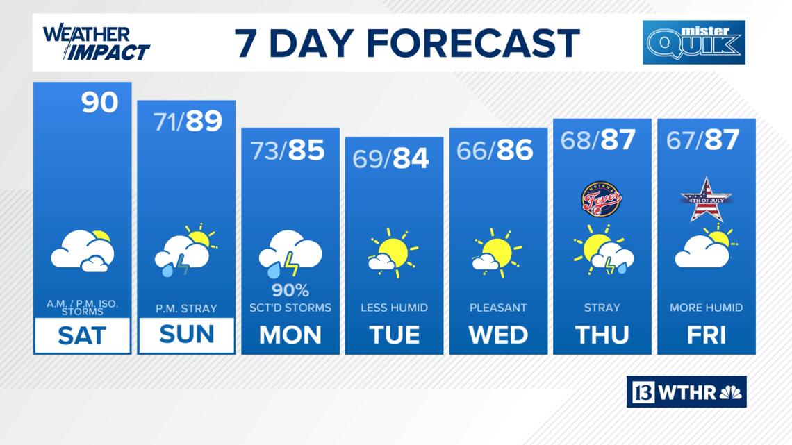
It’s been a week of 90+ degree highs with 100+ degree heat indices, but we’ll see a little relief from that starting today.
INDIANAPOLIS — It’s been a week of 90+ degree highs with 100+ degree heat indices, but we’ll see a little relief from that starting today with an ongoing chance of a few stray storms.


Saturday
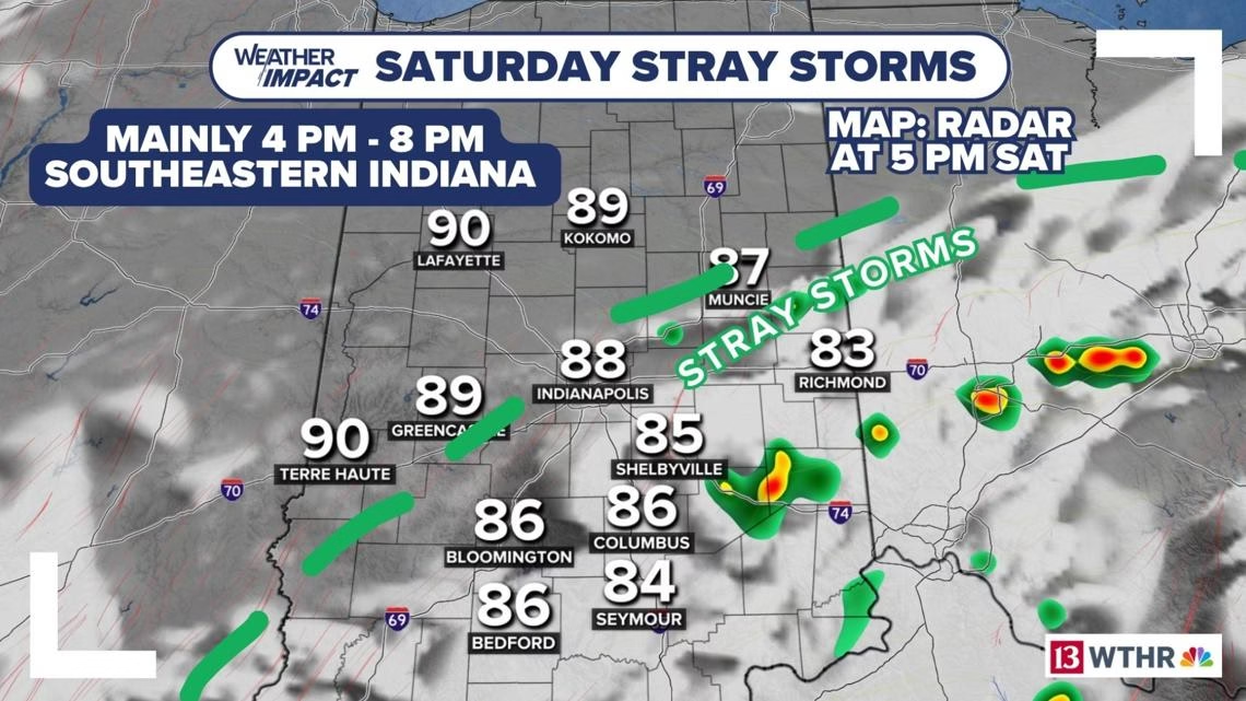
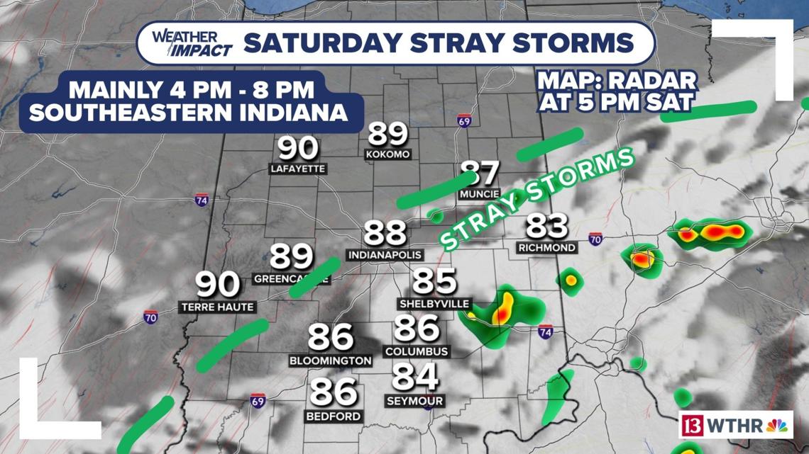
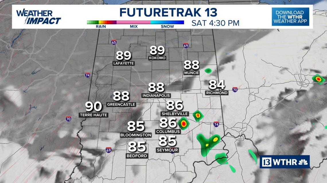
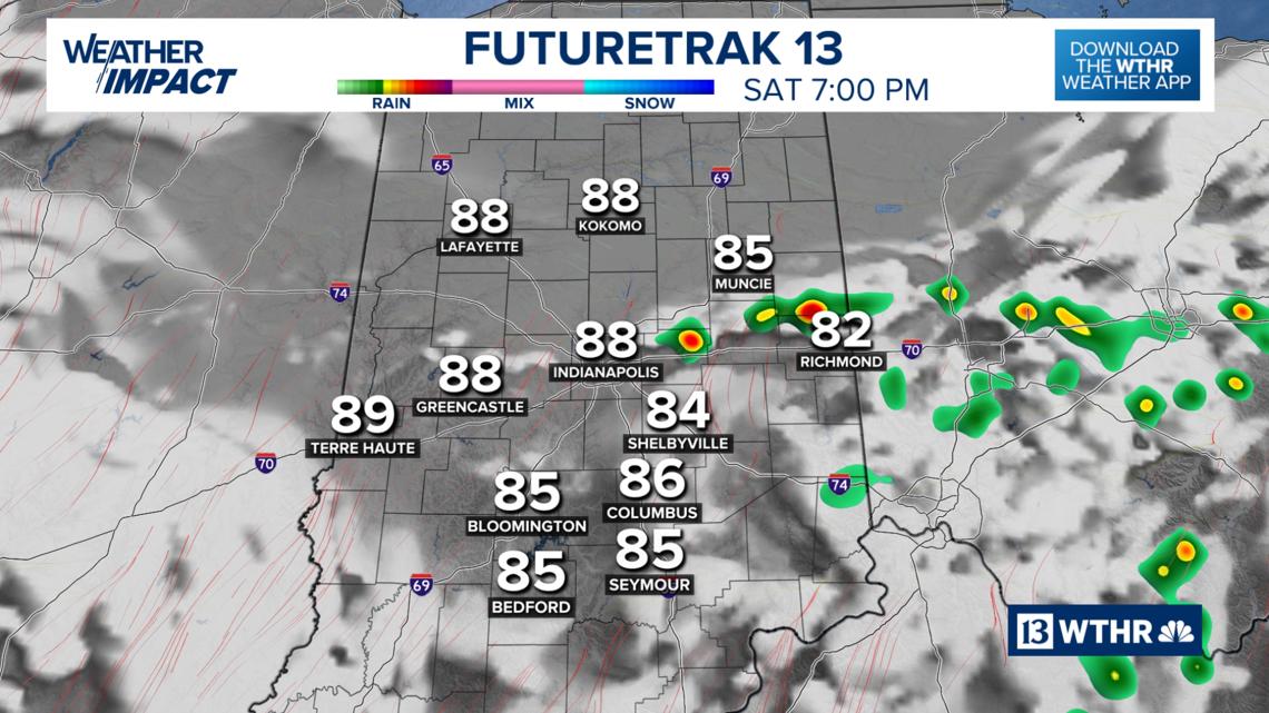
Early morning showers and storms are quieting down for now, but a boundary will stall out over south central Indiana this afternoon prompting additional pop-up showers and storms.
Through early afternoon: Mainly dry with a stray light shower possible, steamy.
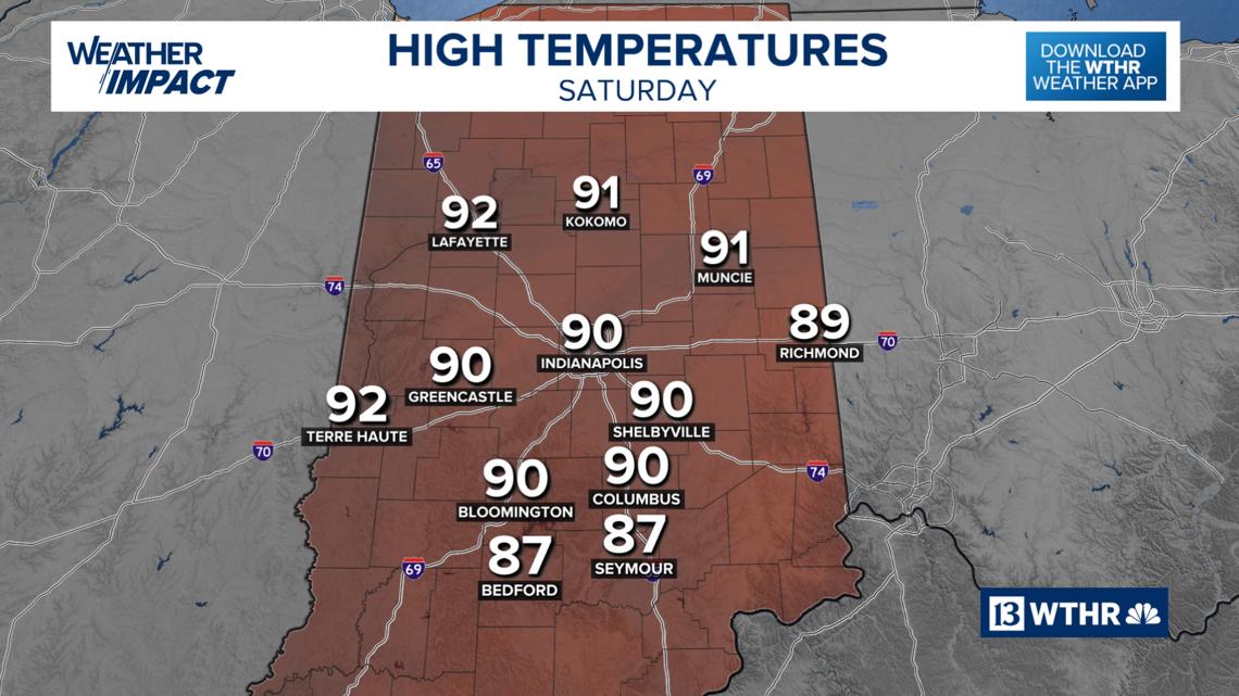
High temperatures: Near 90 degrees, feels like mid 90s.
Best chance of storms timeline: Approximately between 4 p.m. to 8 p.m.
Best chance of storms location: Along and south of I-70 in east central Indiana.


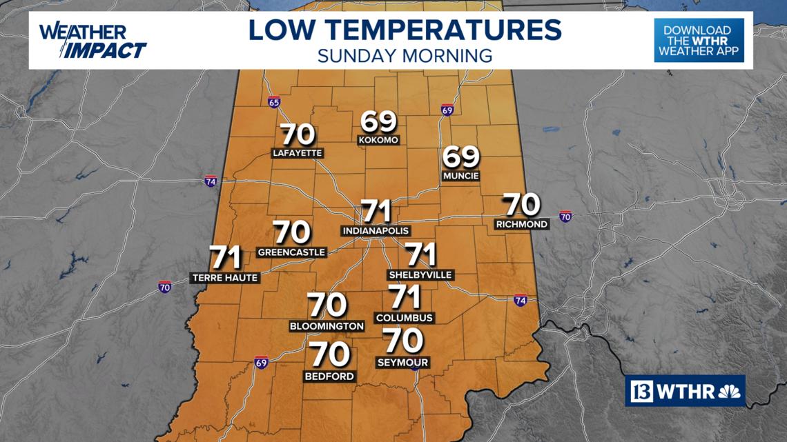
Overnight: Warm and muggy.
Low temperatures: Low 70s.

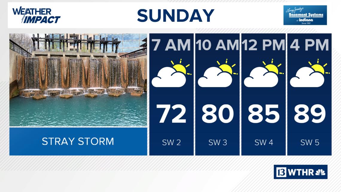
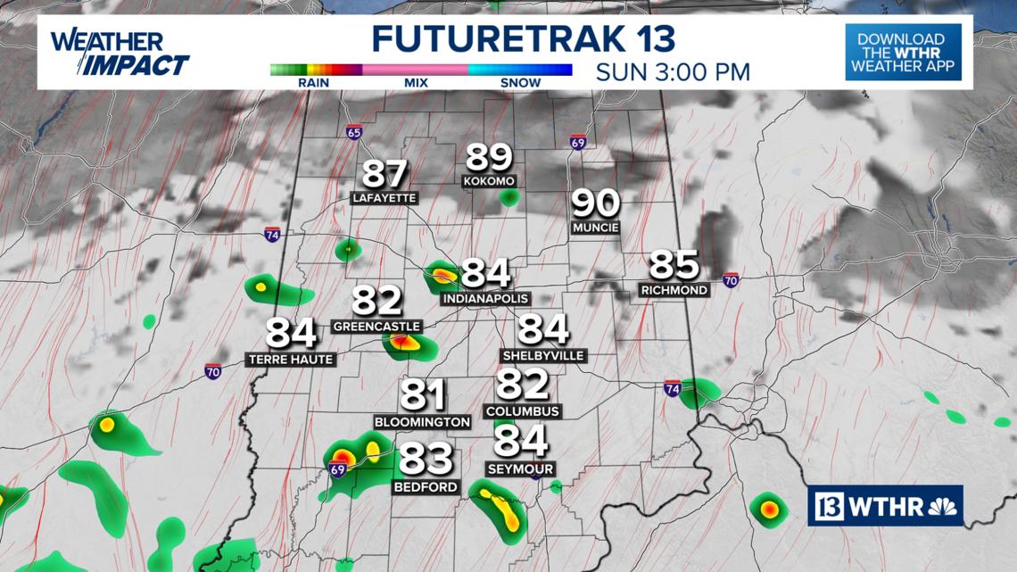
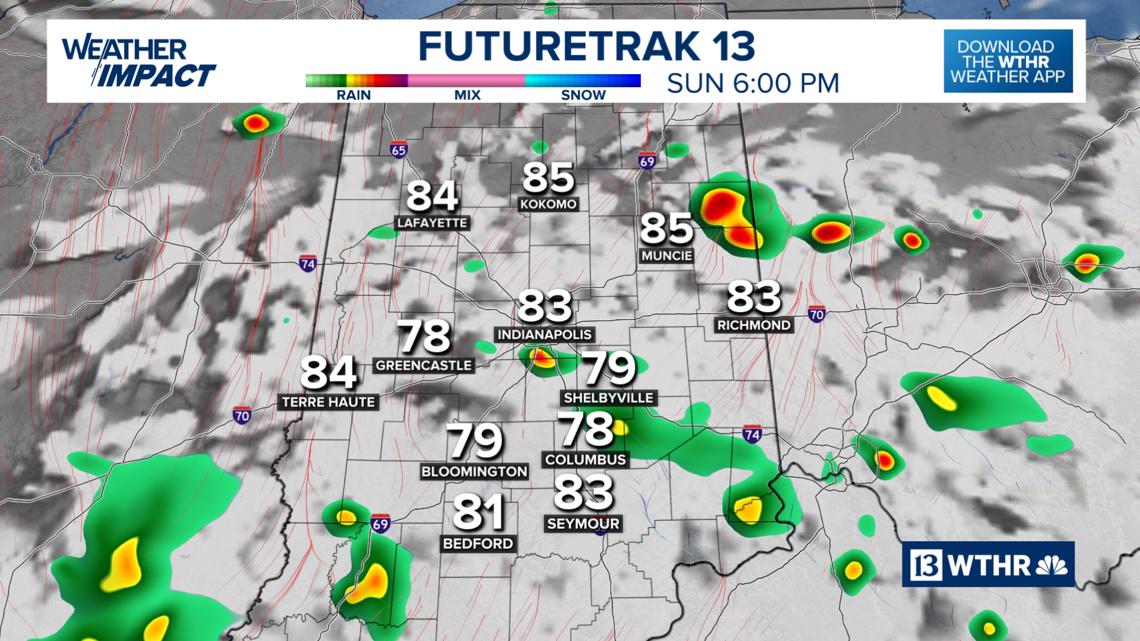
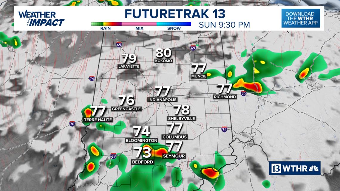
Sunday
High temperatures: Upper 80s, near 90 degrees.
Sky conditions: Mainly dry start to the day with a few stray storms developing area-wide across central Indiana, approximately 2 p.m. with hit-or-miss storms through the evening.


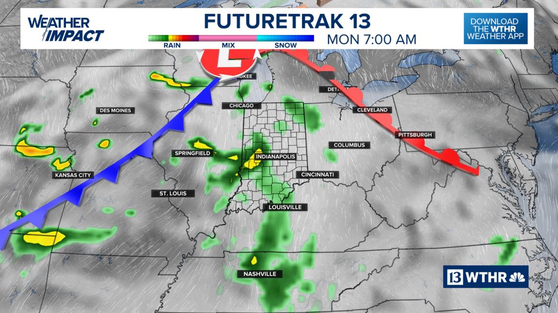
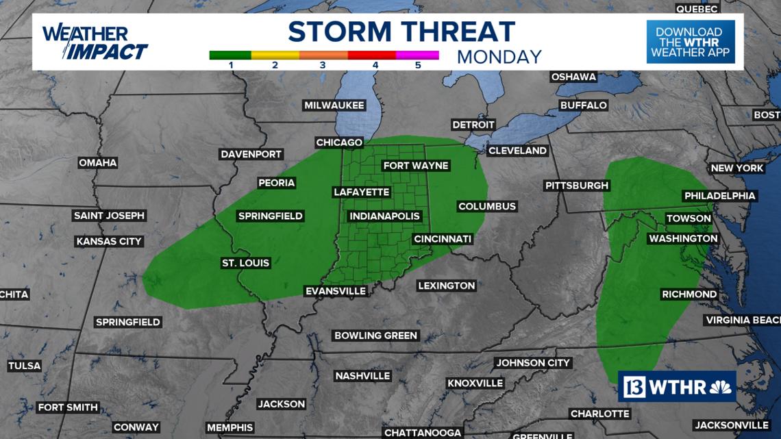
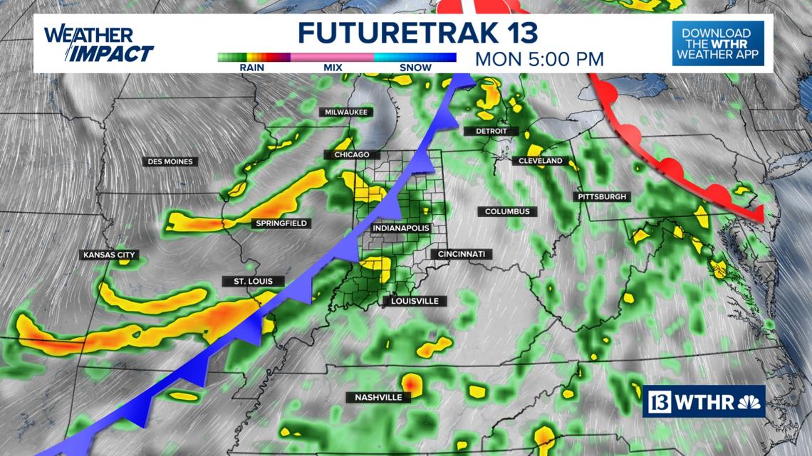
More widespread storms for Monday
Monday will be the transitional day as a cold front slowly tracks across Indiana prompting scattered storms. A few storms may be strong to severe with damaging wind gusts and brief heavy rainfall leading to localized flooding. Temperatures will recover into the mid to upper 80s ahead of the front passing through.


Relief from the extreme humidity taking over starting Tuesday.

Fourth of July holiday preview
You’ll notice lower dew points in the mid 60s bringing a more refreshing air mass, especially after what we’ve experienced this past week.
Wednesday will be another pleasant day for early-July standards with the muggy meter creeping back into the uncomfortable zone on Thursday and for the Fourth of July Friday.
Both Thursday and Friday look mainly dry with only a few stray pop-up storms possible in the heat of the day.
Leave a Reply