
Scattered storms will be possible early in the week, followed by a hot and humid Fourth of July.
DALLAS — Watch live radar and regular forecast updates from our meteorologists on our Smart TV streaming app WFAA+ and download the WFAA mobile app for alerts from our weather team as they come.
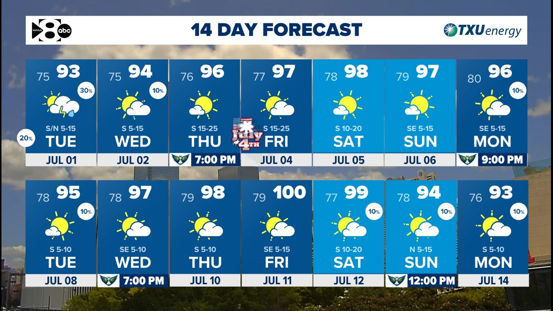
Key Points:
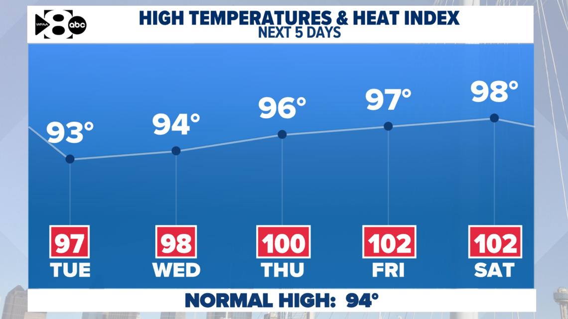
- Afternoon highs in the 90s with triple-digit heat index
- A few storms are possible tonight and Tuesday
- The first 100-degree day of 2025 is around the corner
Summer heat settles in
High temperatures this week will be mostly warmer than normal from morning lows to afternoon highs. Highs will be in the 90s and anywhere from one to four degrees warmer than normal. A southerly wind keeps humidity elevated. That means heat index values are going to be near 100 every day. Stay ready!
Rain chances returning early this week will help temporarily lower daytime highs by a couple of degrees, especially on Tuesday.

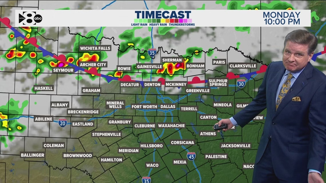
Rain Timeline
Rain chances return tonight and Tuesday. The latest data brings a front into North Texas on Tuesday that could bring in more widely scattered showers and storms in the afternoon.
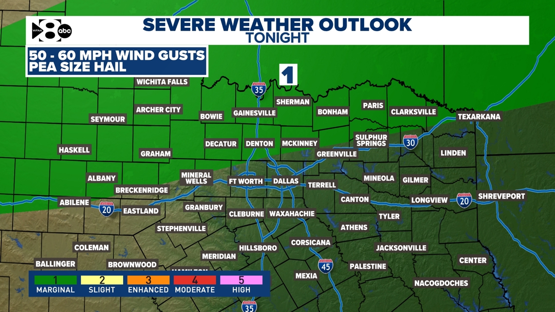
Showers and storms will be possible as early as Monday night and mainly along the Red River. Most storms will stay near the Red River and in Oklahoma. Severe storms are not expected, but an isolated storm could contain 50-60 mph wind gusts and pea size hail. Storms will generally clear out Tuesday morning.
More storms are possible Tuesday afternoon as a stationary boundary hangs out in the area. Again, the threat of severe weather remains low.
Severe storm potential remains low for North Texas. DFW is not included in the outlook.

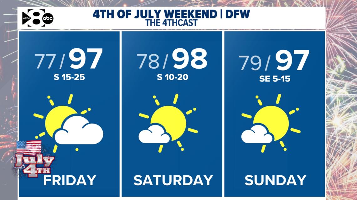
Fourth of July
Most stay rain-free for the 4th of July holiday and the following weekend. Highs will be in the upper 90s with morning lows in the 70s. There is a small chance for an afternoon shower or storm west of Dallas-Fort Worth. Keep that in mind if you are planning on being outdoors!

14-Day Outlook
Temperatures continue to hold steady in the 90s. A ridge of high pressure will keep things pretty consistent for a while. Rain chances are still hard to come by, but the pattern looks a little more unsettled as we start out July. Monday and Tuesday will bring us isolated to scattered showers and storms. Severe weather is not expected.
Plan for sunnier days and rising temps as we inch closer to summer’s peak.
On average, the first 100° day of the year happens around July 1st. DFW has yet to see the first triple-digit day of the year, but it is on the 14-day.

Leave a Reply